
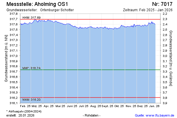
Current data Aholming OS1
note
GW Messstelle im Grundnetz
Groundwater level [m above sealevel]: 317.39
Distance to surface [m]: 2.61
Last value from 13.07.2026 19:19
Ground level [m above sealevel]: 320.00
| Date | Groundwater level [m above sealevel] |
|---|---|
| 13.07.2026 | 317.39 |
| 12.07.2026 | 317.38 |
| 11.07.2026 | 317.39 |
| 10.07.2026 | 317.40 |
| 09.07.2026 | 317.41 |
| 08.07.2026 | 317.41 |
| 07.07.2026 | 317.42 |
| 06.07.2026 | 317.41 |