
- Start >
- Groundwater >
- Waterlevel of upper layer >
- Bayern >
- ADELSHAUSER BERG B 4 >
- Chart of total period

Chart of total period ADELSHAUSER BERG B 4
Groundwater levels of the total period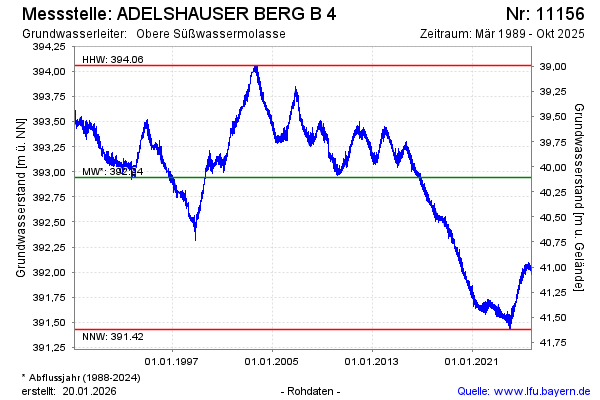
Groundwater level [m above sealevel]: 391.90
Distance to surface [m]: 41.15
Last value from 25.03.2026 15:00
Ground level [m above sealevel]: 433.05
| Date | Groundwater level [m above sealevel] |
|---|---|
| 25.03.2026 | 391.89 |
| 24.03.2026 | 391.82 |
| 23.03.2026 | 391.82 |
| 22.03.2026 | 391.85 |
| 21.03.2026 | 391.85 |
| 20.03.2026 | 391.85 |
| 19.03.2026 | 391.83 |
| 18.03.2026 | 391.82 |
© Bayerisches Landesamt für Umwelt 2026