
Chart of total period ACHSHEIM 6
Groundwater level [m above sealevel]: 438,41
Distance to surface [m]: 1,91
Last value from 30.10.1971 12:00
Ground level [m above sealevel]: 440.32
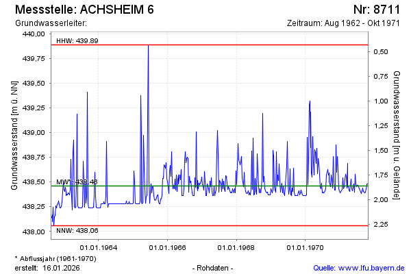
| Date | Groundwater level [m above sealevel] |
|---|---|
| 23.10.1971 | 438.48 |
| 16.10.1971 | 438.48 |
| 09.10.1971 | 438.46 |
| 02.10.1971 | 438.43 |
| 25.09.1971 | 438.40 |
| 18.09.1971 | 438.39 |
| 11.09.1971 | 438.40 |
| 04.09.1971 | 438.40 |