
- Start >
- Groundwater >
- Waterlevel of upper layer >
- Bayern >
- ACHSHEIM 5 >
- Chart of total period

Chart of total period ACHSHEIM 5
Groundwater levels of the total period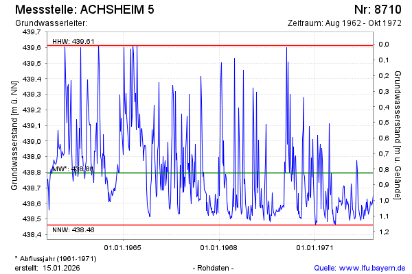
Groundwater level [m above sealevel]: 438.71
Distance to surface [m]: 0.91
Last value from 28.10.1972 12:00
Ground level [m above sealevel]: 439.62
| Date | Groundwater level [m above sealevel] |
|---|---|
| 21.10.1972 | 438.65 |
| 14.10.1972 | 438.61 |
| 07.10.1972 | 438.59 |
| 30.09.1972 | 438.60 |
| 23.09.1972 | 438.61 |
| 16.09.1972 | 438.56 |
| 09.09.1972 | 438.55 |
| 02.09.1972 | 438.53 |
© Bayerisches Landesamt für Umwelt 2026