
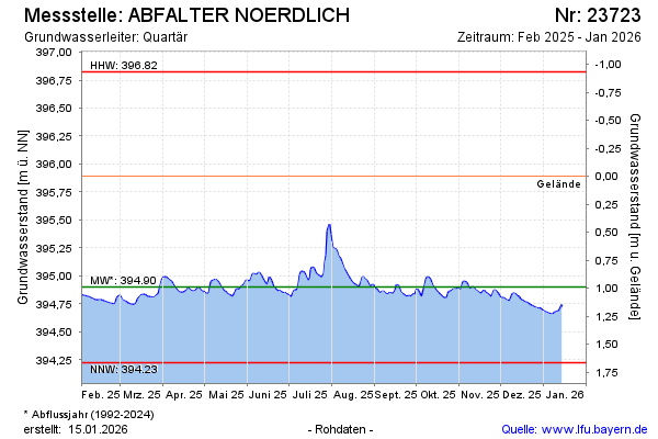
Current data ABFALTER NOERDLICH
Groundwater level [m above sealevel]: 394.74
Distance to surface [m]: 1.15
Last value from 12.07.2026 09:00
Ground level [m above sealevel]: 395.89
| Date | Groundwater level [m above sealevel] |
|---|---|
| 12.07.2026 | 394.74 |
| 11.07.2026 | 394.75 |
| 10.07.2026 | 394.76 |
| 09.07.2026 | 394.76 |
| 08.07.2026 | 394.77 |
| 07.07.2026 | 394.78 |
| 06.07.2026 | 394.78 |
| 05.07.2026 | 394.79 |