
- Start >
- Groundwater >
- Waterlevel of upper layer >
- Bayern >
- 20 KV MAST 5 >
- Year chart of precipitation

Year chart of precipitation 20 KV MAST 5
Groundwater levels of the last 12 months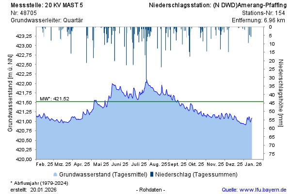
Groundwater level [m above sealevel]: 421,06
Distance to surface [m]: 4,25
Last value from 18.03.2026 15:46
Ground level [m above sealevel]: 425.31
© Bayerisches Landesamt für Umwelt 2026