
- Start >
- Groundwater >
- Flow of springs >
- Unterer Main >
- Salzloch 3/2 >
- Master data

Master data Salzloch 3/2
Site number: 22504
Measuring point system: Grundnetz
Community: Sulzdorf a.d.Lederhecke
District: Rhön-Grabfeld
Measurement data provided by:  Wasserwirtschaftsamt Bad Kissingen
Aquifer: Schilfsandstein (Gipskeuper)
Ground level: 327.00 m above sealevel
Easting: 610870 (ETRS89 / UTM Zone 32N)
Northing: 5568876
Observation period: 20.08.1951 to 04.12.2025
Hauptwerte (Tagesmittelwerte):
Maximum flow: 12.71 l/s
Mean flow: 2.52 l/s
Minimum flow: 0.30 l/s
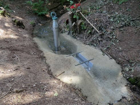
Picture of the measurement site
Location of the station Salzloch 3/2
| Measurement site | Category |
|---|---|
 Autenhausen Autenhausen | Rivers: Runoff, Waterlevel |
| Lohr | Rivers: Runoff, Waterlevel |
| Pfarrweisach | Rivers: Runoff, Waterlevel |
| Römershofen | Rivers: Runoff, Waterlevel, Water temperature, Water temperature |
|
more measurement sites | |

© Bayerisches Landesamt für Umwelt 2025