
- Start >
- Groundwater >
- Waterlevel of deep layer >
- Regnitz >
- Wieseth >
- Chart of total period

Chart of total period Wieseth
Groundwater levels of the total period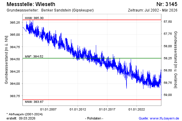
Groundwater level [m above sealevel]: 383.89
Distance to surface [m]: 58.88
Last value from 09.05.2024 13:00
Ground level [m above sealevel]: 442.77
| Date | Groundwater level [m above sealevel] |
|---|---|
| 08.05.2024 | 383.97 |
| 07.05.2024 | 384.03 |
| 06.05.2024 | 384.06 |
| 05.05.2024 | 384.05 |
| 04.05.2024 | 384.03 |
| 03.05.2024 | 384.05 |
| 02.05.2024 | 384.11 |
| 01.05.2024 | 384.07 |
© Bayerisches Landesamt für Umwelt 2024