
- Start >
- Groundwater >
- Waterlevel of deep layer >
- Regnitz >
- WEIDNITZ 20 >
- Chart of total period

Chart of total period WEIDNITZ 20
Groundwater levels of the total period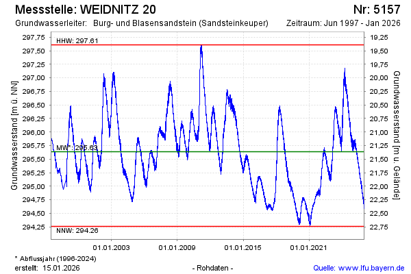
Groundwater level [m above sealevel]: 294.52
Distance to surface [m]: 22.48
Last value from 06.03.2026 10:00
Ground level [m above sealevel]: 317.00
| Date | Groundwater level [m above sealevel] |
|---|---|
| 06.03.2026 | 294.53 |
| 05.03.2026 | 294.54 |
| 04.03.2026 | 294.52 |
| 03.03.2026 | 294.52 |
| 02.03.2026 | 294.52 |
| 01.03.2026 | 294.51 |
| 28.02.2026 | 294.52 |
| 27.02.2026 | 294.54 |
© Bayerisches Landesamt für Umwelt 2026