
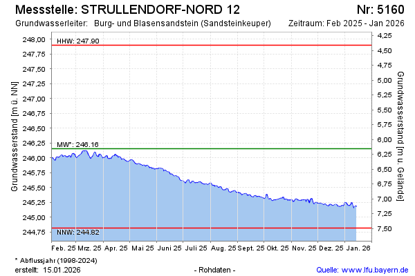
Current data STRULLENDORF-NORD 12
Groundwater level [m above sealevel]: 245.28
Distance to surface [m]: 7.03
Last value from 13.07.2026 10:00
Ground level [m above sealevel]: 252.31
| Date | Groundwater level [m above sealevel] |
|---|---|
| 13.07.2026 | 245.30 |
| 12.07.2026 | 245.30 |
| 11.07.2026 | 245.32 |
| 10.07.2026 | 245.33 |
| 09.07.2026 | 245.33 |
| 08.07.2026 | 245.34 |
| 07.07.2026 | 245.36 |
| 06.07.2026 | 245.35 |