
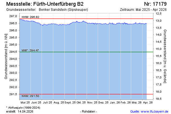
Current data Fürth-Unterfürberg B2
Groundwater level [m above sealevel]: 296.39
Distance to surface [m]: 13.3
Last value from 14.07.2026 10:00
Ground level [m above sealevel]: 309.69
| Date | Groundwater level [m above sealevel] |
|---|---|
| 14.07.2026 | 296.42 |
| 13.07.2026 | 296.41 |
| 12.07.2026 | 296.40 |
| 11.07.2026 | 296.43 |
| 10.07.2026 | 296.44 |
| 09.07.2026 | 296.46 |
| 08.07.2026 | 296.48 |
| 07.07.2026 | 296.49 |