
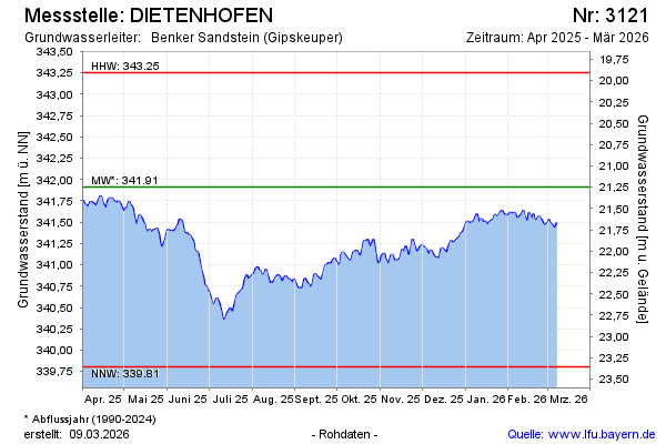
Current data DIETENHOFEN
Groundwater level [m above sealevel]: 340.58
Distance to surface [m]: 22.58
Last value from 13.07.2026 13:00
Ground level [m above sealevel]: 363.16
| Date | Groundwater level [m above sealevel] |
|---|---|
| 13.07.2026 | 340.61 |
| 12.07.2026 | 340.59 |
| 11.07.2026 | 340.57 |
| 10.07.2026 | 340.63 |
| 09.07.2026 | 340.62 |
| 08.07.2026 | 340.66 |
| 07.07.2026 | 340.68 |
| 06.07.2026 | 340.68 |