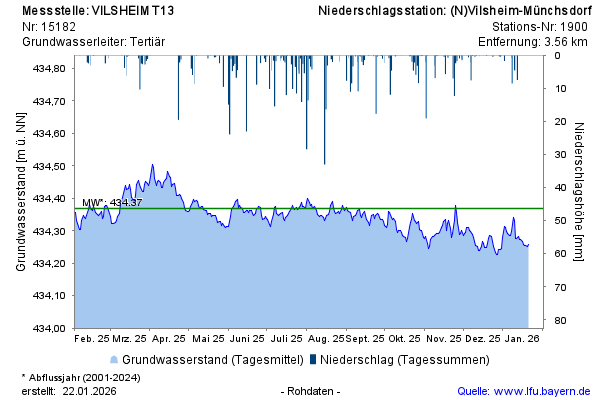
Year chart of precipitation Vilsheim T13
Groundwater level [m above sealevel]: 434,01
Distance to surface [m]: 30,17
Last value from 22.07.2026 10:00
Ground level [m above sealevel]: 464.18

Groundwater level [m above sealevel]: 434,01
Distance to surface [m]: 30,17
Last value from 22.07.2026 10:00
Ground level [m above sealevel]: 464.18