
- Start >
- Groundwater >
- Waterlevel of deep layer >
- Untere Donau >
- Unterholzhausen T15 >
- Chart of total period

Chart of total period Unterholzhausen T15
Groundwater levels of the total period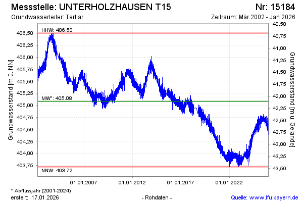
Groundwater level [m above sealevel]: 404.53
Distance to surface [m]: 42.66
Last value from 14.12.2025 10:00
Ground level [m above sealevel]: 447.19
| Date | Groundwater level [m above sealevel] |
|---|---|
| 14.12.2025 | 404.53 |
| 13.12.2025 | 404.52 |
| 12.12.2025 | 404.54 |
| 11.12.2025 | 404.52 |
| 10.12.2025 | 404.53 |
| 09.12.2025 | 404.54 |
| 08.12.2025 | 404.53 |
| 07.12.2025 | 404.57 |
© Bayerisches Landesamt für Umwelt 2025