
- Start >
- Groundwater >
- Waterlevel of deep layer >
- Untere Donau >
- Postmünster T5 >
- Chart of total period

Chart of total period Postmünster T5
Groundwater levels of the total period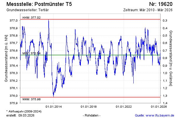
note
Messstelle ca. 3 Wochen außer Betrieb
Groundwater level [m above sealevel]: 376.53
Distance to surface [m]: 0.77
Last value from 23.05.2026 10:00
Ground level [m above sealevel]: 377.30
| Date | Groundwater level [m above sealevel] |
|---|---|
| 23.05.2026 | 376.54 |
| 22.05.2026 | 376.54 |
| 21.05.2026 | 376.55 |
| 20.05.2026 | 376.55 |
| 19.05.2026 | 376.56 |
| 18.05.2026 | 376.57 |
| 17.05.2026 | 376.57 |
| 16.05.2026 | 376.58 |
© Bayerisches Landesamt für Umwelt 2026