
- Start >
- Groundwater >
- Waterlevel of deep layer >
- Untere Donau >
- OBERPOERING_OP1 >
- Chart of total period

Chart of total period OBERPOERING_OP1
Groundwater levels of the total period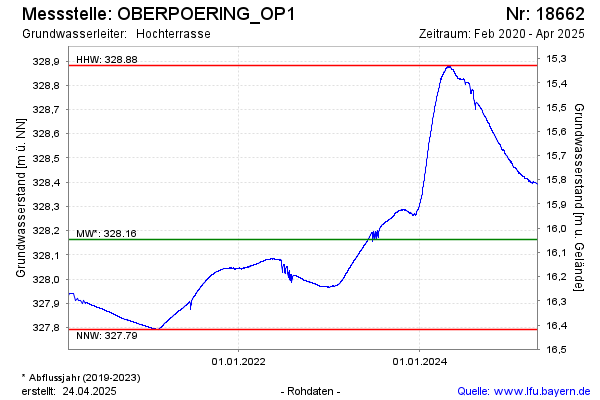
Groundwater level [m above sealevel]: 328.88
Distance to surface [m]: 15.33
Last value from 06.05.2024 08:00
Ground level [m above sealevel]: 344.21
| Date | Groundwater level [m above sealevel] |
|---|---|
| 06.05.2024 | 328.88 |
| 05.05.2024 | 328.88 |
| 04.05.2024 | 328.87 |
| 03.05.2024 | 328.87 |
| 02.05.2024 | 328.88 |
| 01.05.2024 | 328.88 |
| 30.04.2024 | 328.88 |
| 29.04.2024 | 328.87 |
© Bayerisches Landesamt für Umwelt 2024