Year chart of precipitation MITTERFECKING W2
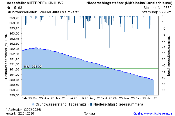
Groundwater level [m above sealevel]: 350,40
Distance to surface [m]: 22,90
Last value from 14.07.2026 10:00
Ground level [m above sealevel]: 373.30

Groundwater level [m above sealevel]: 350,40
Distance to surface [m]: 22,90
Last value from 14.07.2026 10:00
Ground level [m above sealevel]: 373.30