
Current data Mallersdorf T4
note
GW Messstelle im Grundnetz
Groundwater level [m above sealevel]: 379.07
Distance to surface [m]: 2.41
Last value from 14.07.2026 08:00
Ground level [m above sealevel]: 381.48
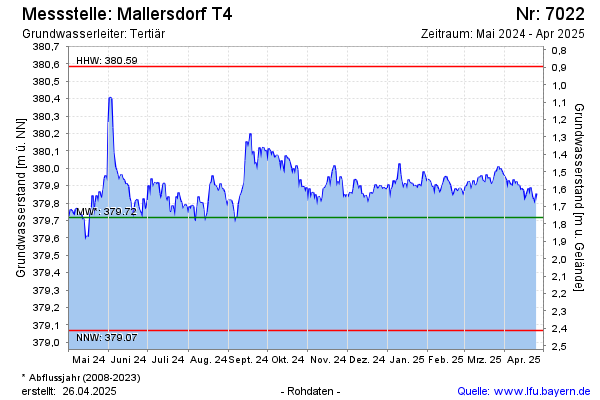
| Date | Groundwater level [m above sealevel] |
|---|---|
| 14.07.2026 | 379.09 |
| 13.07.2026 | 379.09 |
| 12.07.2026 | 379.21 |
| 11.07.2026 | 379.24 |
| 10.07.2026 | 379.35 |
| 09.07.2026 | 379.39 |
| 08.07.2026 | 379.40 |
| 07.07.2026 | 379.45 |