
- Start >
- Groundwater >
- Waterlevel of deep layer >
- Untere Donau >
- KIRSCHFURT 181 >
- Chart of total period

Chart of total period KIRSCHFURT 181
Groundwater levels of the total period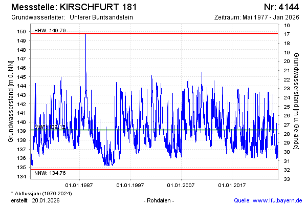
Groundwater level [m above sealevel]: 137.25
Distance to surface [m]: 29.46
Last value from 22.05.2026 10:00
Ground level [m above sealevel]: 166.71
| Date | Groundwater level [m above sealevel] |
|---|---|
| 22.05.2026 | 137.27 |
| 21.05.2026 | 137.36 |
| 20.05.2026 | 137.60 |
| 19.05.2026 | 137.79 |
| 18.05.2026 | 137.95 |
| 17.05.2026 | 138.24 |
| 16.05.2026 | 138.57 |
| 15.05.2026 | 138.71 |
© Bayerisches Landesamt für Umwelt 2026