
Current data Hölsbrunn T2
note
GW Messstelle im Grundnetz
Groundwater level [m above sealevel]: 428.43
Distance to surface [m]: 80.22
Last value from 13.07.2026 08:00
Ground level [m above sealevel]: 508.65
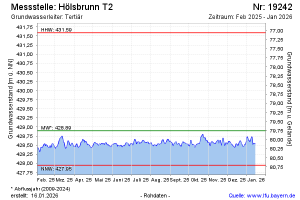
| Date | Groundwater level [m above sealevel] |
|---|---|
| 12.07.2026 | 428.44 |
| 11.07.2026 | 428.46 |
| 10.07.2026 | 428.48 |
| 09.07.2026 | 428.47 |
| 08.07.2026 | 428.48 |
| 07.07.2026 | 428.48 |
| 06.07.2026 | 428.44 |
| 05.07.2026 | 428.43 |