
Current data HENGERSBERG BR I
note
GW Messstelle im Verdichtungsnetz
Groundwater level [m above sealevel]: 309.30
Distance to surface [m]: 5.95
Last value from 14.07.2026 21:00
Ground level [m above sealevel]: 315.25
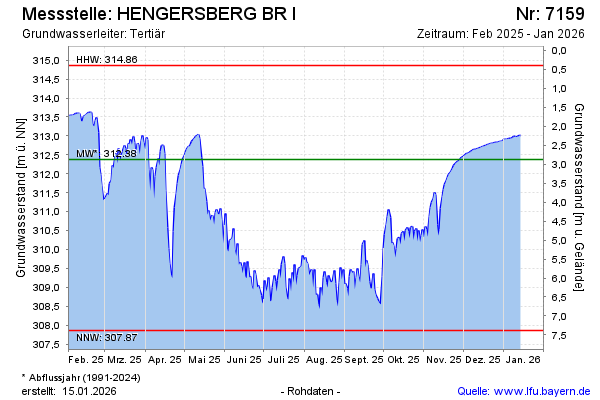
| Date | Groundwater level [m above sealevel] |
|---|---|
| 14.07.2026 | 309.42 |
| 13.07.2026 | 309.48 |
| 12.07.2026 | 309.80 |
| 11.07.2026 | 310.16 |
| 10.07.2026 | 309.87 |
| 09.07.2026 | 309.84 |
| 08.07.2026 | 309.53 |
| 07.07.2026 | 309.80 |