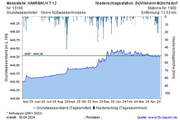
Year chart of precipitation HAARBACH T12
Groundwater level [m above sealevel]: 444,18
Distance to surface [m]: 2,03
Last value from 23.07.2026 10:00
Ground level [m above sealevel]: 446.21

Groundwater level [m above sealevel]: 444,18
Distance to surface [m]: 2,03
Last value from 23.07.2026 10:00
Ground level [m above sealevel]: 446.21