
- Start >
- Groundwater >
- Waterlevel of deep layer >
- Untere Donau >
- FAHRNDORF BO. C >
- Chart of total period

Chart of total period FAHRNDORF BO. C
Groundwater levels of the total period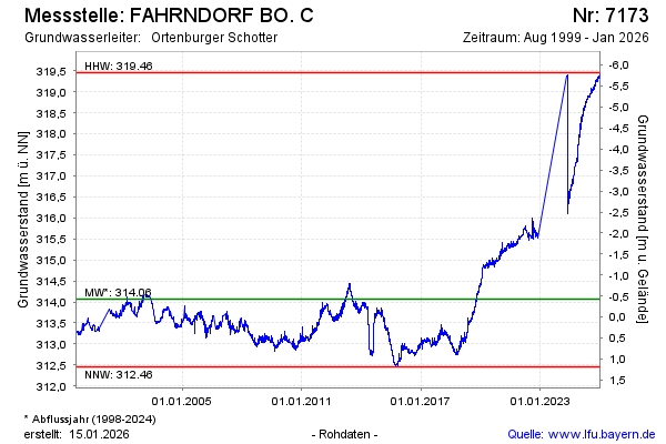
note
GW Messstelle im Grukndnetz
Groundwater level [m above sealevel]: 319.62
Distance to surface [m]: -5.98
Last value from 14.04.2026 08:00
Ground level [m above sealevel]: 313.64
| Date | Groundwater level [m above sealevel] |
|---|---|
| 14.04.2026 | 319.63 |
| 13.04.2026 | 319.63 |
| 12.04.2026 | 319.61 |
| 11.04.2026 | 319.60 |
| 10.04.2026 | 319.59 |
| 09.04.2026 | 319.58 |
| 08.04.2026 | 319.57 |
| 07.04.2026 | 319.57 |
© Bayerisches Landesamt für Umwelt 2026