
- Start >
- Groundwater >
- Waterlevel of deep layer >
- Unterer Main >
- Waldzell S 2 >
- Chart of total period

Chart of total period Waldzell S 2
Groundwater levels of the total period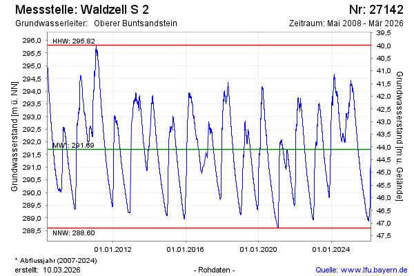
Groundwater level [m above sealevel]: 293.86
Distance to surface [m]: 41.94
Last value from 02.05.2024 10:00
Ground level [m above sealevel]: 335.80
| Date | Groundwater level [m above sealevel] |
|---|---|
| 02.05.2024 | 293.85 |
| 01.05.2024 | 293.83 |
| 30.04.2024 | 293.80 |
| 29.04.2024 | 293.79 |
| 28.04.2024 | 293.84 |
| 27.04.2024 | 293.87 |
| 26.04.2024 | 293.89 |
| 25.04.2024 | 293.88 |
© Bayerisches Landesamt für Umwelt 2024