
Current data Schleerieth MU2
note
Arteser
Groundwater level [m above sealevel]: 236.55
Distance to surface [m]: -0.72
Last value from 13.07.2026 10:00
Ground level [m above sealevel]: 235.83
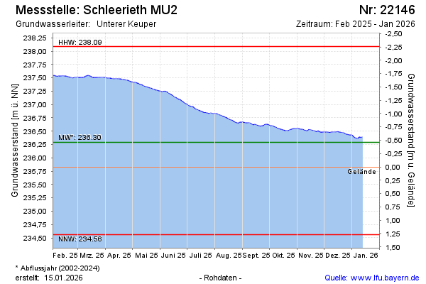
| Date | Groundwater level [m above sealevel] |
|---|---|
| 12.07.2026 | 236.57 |
| 11.07.2026 | 236.57 |
| 10.07.2026 | 236.58 |
| 09.07.2026 | 236.59 |
| 08.07.2026 | 236.59 |
| 07.07.2026 | 236.60 |
| 06.07.2026 | 236.61 |
| 05.07.2026 | 236.61 |