
- Start >
- Groundwater >
- Waterlevel of deep layer >
- Unterer Main >
- ROTHOF (WÜ-MU 8) >
- Chart of total period

Chart of total period ROTHOF (WÜ-MU 8)
Groundwater levels of the total period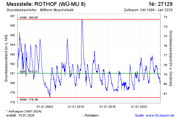
Groundwater level [m above sealevel]: 182.38
Distance to surface [m]: 77.51
Last value from 28.04.2024 10:00
Ground level [m above sealevel]: 259.89
| Date | Groundwater level [m above sealevel] |
|---|---|
| 27.04.2024 | 182.40 |
| 26.04.2024 | 182.42 |
| 25.04.2024 | 182.43 |
| 24.04.2024 | 182.44 |
| 23.04.2024 | 182.39 |
| 22.04.2024 | 182.36 |
| 21.04.2024 | 182.38 |
| 20.04.2024 | 182.36 |
© Bayerisches Landesamt für Umwelt 2024