
- Start >
- Groundwater >
- Waterlevel of deep layer >
- Unterer Main >
- OBERPLEICHFELD (9) >
- Chart of total period

Chart of total period OBERPLEICHFELD (9)
Groundwater levels of the total period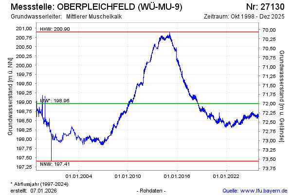
Groundwater level [m above sealevel]: 198.70
Distance to surface [m]: 72.26
Last value from 16.03.2026 10:53
Ground level [m above sealevel]: 270.96
| Date | Groundwater level [m above sealevel] |
|---|---|
| 16.03.2026 | 198.72 |
| 15.03.2026 | 198.72 |
| 14.03.2026 | 198.76 |
| 13.03.2026 | 198.74 |
| 12.03.2026 | 198.70 |
| 11.03.2026 | 198.72 |
| 10.03.2026 | 198.71 |
| 09.03.2026 | 198.71 |
© Bayerisches Landesamt für Umwelt 2026