
- Start >
- Groundwater >
- Waterlevel of deep layer >
- Unterer Main >
- Leinach MU 2 >
- Chart of total period

Chart of total period Leinach MU 2
Groundwater levels of the total period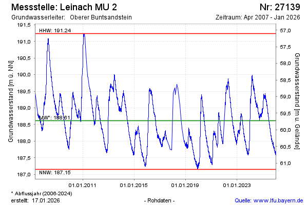
Groundwater level [m above sealevel]: 188.88
Distance to surface [m]: 59.46
Last value from 12.04.2026 10:00
Ground level [m above sealevel]: 248.34
| Date | Groundwater level [m above sealevel] |
|---|---|
| 12.04.2026 | 188.90 |
| 11.04.2026 | 188.90 |
| 10.04.2026 | 188.90 |
| 09.04.2026 | 188.89 |
| 08.04.2026 | 188.88 |
| 07.04.2026 | 188.88 |
| 06.04.2026 | 188.88 |
| 05.04.2026 | 188.93 |
© Bayerisches Landesamt für Umwelt 2026