
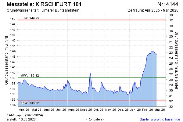
Current data KIRSCHFURT 181
Groundwater level [m above sealevel]: 136.39
Distance to surface [m]: 30.32
Last value from 13.07.2026 10:00
Ground level [m above sealevel]: 166.71
| Date | Groundwater level [m above sealevel] |
|---|---|
| 13.07.2026 | 136.40 |
| 12.07.2026 | 136.45 |
| 11.07.2026 | 136.53 |
| 10.07.2026 | 136.55 |
| 09.07.2026 | 136.56 |
| 08.07.2026 | 136.60 |
| 07.07.2026 | 136.54 |
| 06.07.2026 | 136.45 |