
- Start >
- Groundwater >
- Waterlevel of deep layer >
- Unterer Main >
- Hergolshausen MU1 >
- Current data

Current data Hergolshausen MU1
Groundwater levels of the last 12 months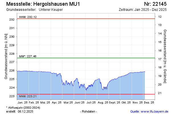
note
Grundwasserstand durch Entnahme beeinflusst
Groundwater level [m above sealevel]: 225.56
Distance to surface [m]: 18.80
Last value from 05.05.2024 10:00
Ground level [m above sealevel]: 244.36
| Date | Groundwater level [m above sealevel] |
|---|---|
| 05.05.2024 | 225.57 |
| 04.05.2024 | 225.54 |
| 03.05.2024 | 225.52 |
| 02.05.2024 | 225.43 |
| 01.05.2024 | 225.41 |
| 30.04.2024 | 225.38 |
| 29.04.2024 | 225.41 |
| 28.04.2024 | 225.49 |
© Bayerisches Landesamt für Umwelt 2024