
- Start >
- Groundwater >
- Waterlevel of deep layer >
- Obere Donau >
- Zusmarshausen T7 >
- Chart of total period

Chart of total period Zusmarshausen T7
Groundwater levels of the total period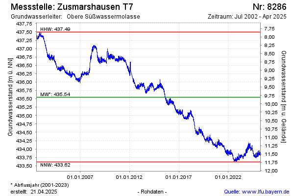
Groundwater level [m above sealevel]: 434.05
Distance to surface [m]: 11.30
Last value from 25.04.2024 08:00
Ground level [m above sealevel]: 445.35
| Date | Groundwater level [m above sealevel] |
|---|---|
| 25.04.2024 | 434.06 |
| 24.04.2024 | 434.05 |
| 23.04.2024 | 434.03 |
| 22.04.2024 | 434.02 |
| 21.04.2024 | 434.03 |
| 20.04.2024 | 434.03 |
| 19.04.2024 | 434.04 |
| 18.04.2024 | 434.03 |
© Bayerisches Landesamt für Umwelt 2024