
- Start >
- Groundwater >
- Waterlevel of deep layer >
- Obere Donau >
- Wilburgstetten GM 5B T >
- Current data

Current data Wilburgstetten GM 5B T
Groundwater levels of the last 12 months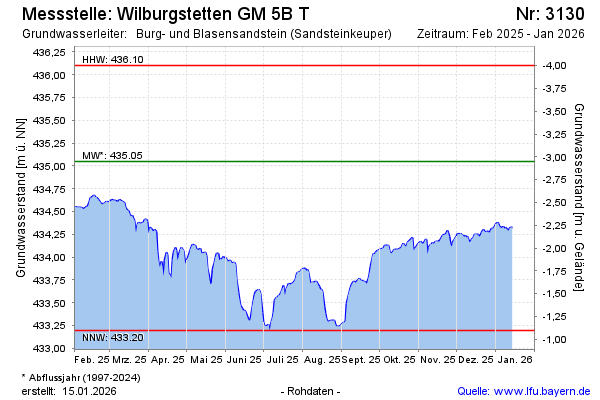
Groundwater level [m above sealevel]: 433.99
Distance to surface [m]: -1.83
Last value from 29.05.2026 13:00
Ground level [m above sealevel]: 432.16
| Date | Groundwater level [m above sealevel] |
|---|---|
| 29.05.2026 | 434.01 |
| 28.05.2026 | 433.98 |
| 27.05.2026 | 433.97 |
| 26.05.2026 | 433.96 |
| 25.05.2026 | 433.87 |
| 24.05.2026 | 434.06 |
| 23.05.2026 | 434.16 |
| 22.05.2026 | 434.18 |
© Bayerisches Landesamt für Umwelt 2026