
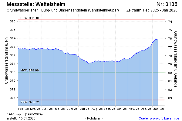
Current data Wettelsheim
Groundwater level [m above sealevel]: 382.21
Distance to surface [m]: 77.74
Last value from 16.06.2026 13:00
Ground level [m above sealevel]: 459.95
| Date | Groundwater level [m above sealevel] |
|---|---|
| 16.06.2026 | 382.25 |
| 15.06.2026 | 382.25 |
| 14.06.2026 | 382.24 |
| 13.06.2026 | 382.24 |
| 12.06.2026 | 382.25 |
| 11.06.2026 | 382.29 |
| 10.06.2026 | 382.33 |
| 09.06.2026 | 382.35 |