
- Start >
- Groundwater >
- Waterlevel of deep layer >
- Obere Donau >
- UNTERPFRAUNDORF W1 >
- Chart of total period

Chart of total period UNTERPFRAUNDORF W1
Groundwater levels of the total period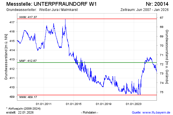
Groundwater level [m above sealevel]: 411.91
Distance to surface [m]: 72.58
Last value from 21.05.2024 10:00
Ground level [m above sealevel]: 484.49
| Date | Groundwater level [m above sealevel] |
|---|---|
| 21.05.2024 | 411.91 |
| 20.05.2024 | 411.88 |
| 19.05.2024 | 411.88 |
| 18.05.2024 | 411.89 |
| 17.05.2024 | 411.91 |
| 16.05.2024 | 411.93 |
| 15.05.2024 | 411.93 |
| 14.05.2024 | 411.93 |
© Bayerisches Landesamt für Umwelt 2024