
Current data SCHAITDORF 604
Groundwater level [m above sealevel]: 359.04
Distance to surface [m]: 81.11
Last value from 16.06.2026 11:50
Ground level [m above sealevel]: 440.15
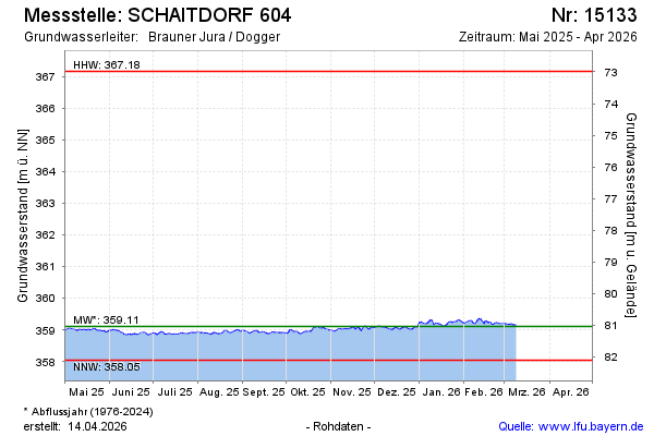
| Date | Groundwater level [m above sealevel] |
|---|---|
| 16.06.2026 | 359.06 |
| 15.06.2026 | 359.06 |
| 14.06.2026 | 359.06 |
| 13.06.2026 | 359.05 |
| 12.06.2026 | 359.04 |
| 11.06.2026 | 359.06 |
| 10.06.2026 | 359.09 |
| 09.06.2026 | 359.11 |