
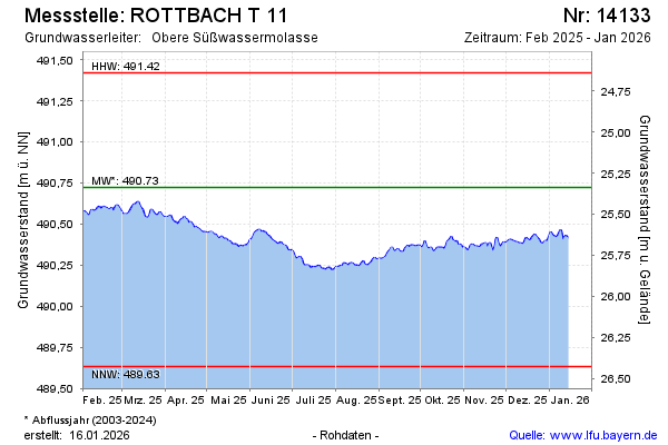
Current data ROTTBACH T 11
Groundwater level [m above sealevel]: 489.90
Distance to surface [m]: 26.16
Last value from 12.07.2026 09:00
Ground level [m above sealevel]: 516.06
| Date | Groundwater level [m above sealevel] |
|---|---|
| 12.07.2026 | 489.91 |
| 11.07.2026 | 489.92 |
| 10.07.2026 | 489.93 |
| 09.07.2026 | 489.93 |
| 08.07.2026 | 489.94 |
| 07.07.2026 | 489.95 |
| 06.07.2026 | 489.94 |
| 05.07.2026 | 489.94 |