
- Start >
- Groundwater >
- Waterlevel of deep layer >
- Obere Donau >
- RÖCKERSBÜHL Kms1 >
- Chart of total period

Chart of total period RÖCKERSBÜHL Kms1
Groundwater levels of the total period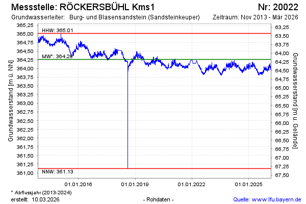
Groundwater level [m above sealevel]: 363.87
Distance to surface [m]: 64.57
Last value from 02.05.2026 10:00
Ground level [m above sealevel]: 428.44
| Date | Groundwater level [m above sealevel] |
|---|---|
| 02.05.2026 | 363.88 |
| 01.05.2026 | 363.87 |
| 30.04.2026 | 363.87 |
| 29.04.2026 | 363.90 |
| 28.04.2026 | 363.92 |
| 27.04.2026 | 363.91 |
| 26.04.2026 | 363.91 |
| 25.04.2026 | 363.94 |
© Bayerisches Landesamt für Umwelt 2026