
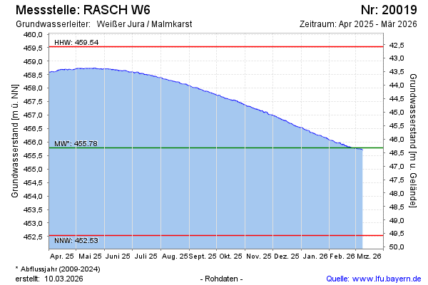
Current data RASCH W6
Groundwater level [m above sealevel]: 454.99
Distance to surface [m]: 47.12
Last value from 24.06.2026 10:00
Ground level [m above sealevel]: 502.11
| Date | Groundwater level [m above sealevel] |
|---|---|
| 28.06.2026 | 454.96 |
| 27.06.2026 | 454.96 |
| 26.06.2026 | 454.97 |
| 25.06.2026 | 454.98 |
| 24.06.2026 | 454.99 |
| 23.06.2026 | 455.00 |
| 22.06.2026 | 455.00 |
| 21.06.2026 | 455.00 |