
- Start >
- Groundwater >
- Waterlevel of deep layer >
- Obere Donau >
- Polsingen-Döckingen >
- Chart of total period

Chart of total period Polsingen-Döckingen
Groundwater levels of the total period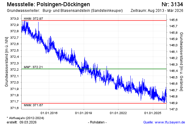
Groundwater level [m above sealevel]: 371.63
Distance to surface [m]: 146.95
Last value from 29.05.2026 13:00
Ground level [m above sealevel]: 518.58
| Date | Groundwater level [m above sealevel] |
|---|---|
| 29.05.2026 | 371.64 |
| 28.05.2026 | 371.66 |
| 27.05.2026 | 371.67 |
| 26.05.2026 | 371.64 |
| 25.05.2026 | 371.62 |
| 24.05.2026 | 371.64 |
| 23.05.2026 | 371.64 |
| 22.05.2026 | 371.64 |
© Bayerisches Landesamt für Umwelt 2026