
- Start >
- Groundwater >
- Waterlevel of deep layer >
- Obere Donau >
- PIPINSRIED T2t >
- Chart of total period

Chart of total period PIPINSRIED T2t
Groundwater levels of the total period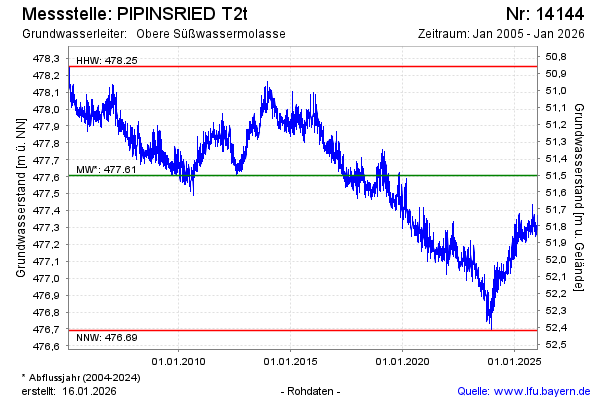
Groundwater level [m above sealevel]: 476.96
Distance to surface [m]: 52.15
Last value from 30.04.2024 09:00
Ground level [m above sealevel]: 529.11
| Date | Groundwater level [m above sealevel] |
|---|---|
| 30.04.2024 | 476.96 |
| 29.04.2024 | 476.96 |
| 28.04.2024 | 476.99 |
| 27.04.2024 | 477.01 |
| 26.04.2024 | 477.02 |
| 25.04.2024 | 477.02 |
| 24.04.2024 | 477.01 |
| 23.04.2024 | 476.99 |
© Bayerisches Landesamt für Umwelt 2024