
- Start >
- Groundwater >
- Waterlevel of deep layer >
- Obere Donau >
- Obermenzing T 3 F >
- Chart of total period

Chart of total period Obermenzing T 3 F
Groundwater levels of the total period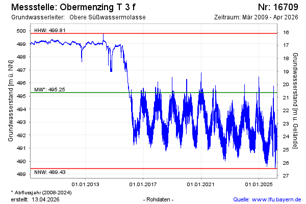
Groundwater level [m above sealevel]: 492.75
Distance to surface [m]: 23.14
Last value from 22.01.2026 10:00
Ground level [m above sealevel]: 515.89
| Date | Groundwater level [m above sealevel] |
|---|---|
| 22.01.2026 | 492.79 |
| 21.01.2026 | 492.93 |
| 20.01.2026 | 493.29 |
| 19.01.2026 | 493.64 |
| 18.01.2026 | 493.39 |
| 17.01.2026 | 492.63 |
| 16.01.2026 | 492.13 |
| 15.01.2026 | 492.37 |
© Bayerisches Landesamt für Umwelt 2026