
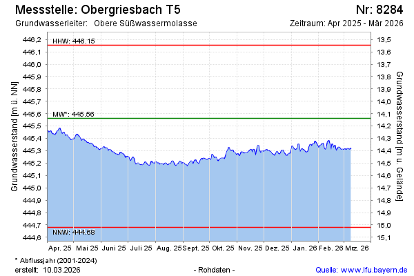
Current data Obergriesbach T5
Groundwater level [m above sealevel]: 445.01
Distance to surface [m]: 14.69
Last value from 13.07.2026 09:00
Ground level [m above sealevel]: 459.70
| Date | Groundwater level [m above sealevel] |
|---|---|
| 12.07.2026 | 445.02 |
| 11.07.2026 | 445.03 |
| 10.07.2026 | 445.04 |
| 09.07.2026 | 445.04 |
| 08.07.2026 | 445.05 |
| 07.07.2026 | 445.06 |
| 06.07.2026 | 445.05 |
| 05.07.2026 | 445.04 |