
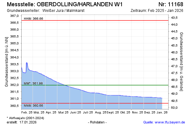
Current data Oberdolling/Harlanden
Groundwater level [m above sealevel]: 361,01
Distance to surface [m]: 49,35
Last value from 22.07.2026 10:00
Ground level [m above sealevel]: 410.36
| Date | Groundwater level [m above sealevel] |
|---|---|
| 22.07.2026 | 361.01 |
| 21.07.2026 | 361.02 |
| 20.07.2026 | 361.02 |
| 19.07.2026 | 361.03 |
| 18.07.2026 | 361.03 |
| 17.07.2026 | 361.04 |
| 16.07.2026 | 361.04 |
| 15.07.2026 | 361.05 |