
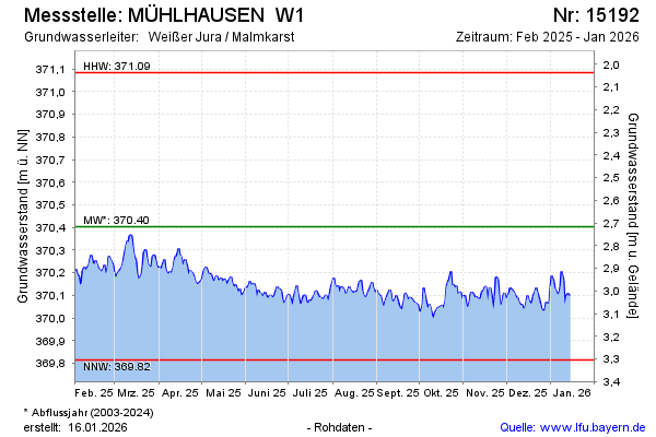
Current data MÜHLHAUSEN W1
Groundwater level [m above sealevel]: 369.90
Distance to surface [m]: 3.22
Last value from 15.07.2026 10:00
Ground level [m above sealevel]: 373.12
| Date | Groundwater level [m above sealevel] |
|---|---|
| 15.07.2026 | 369.93 |
| 14.07.2026 | 369.93 |
| 13.07.2026 | 369.93 |
| 12.07.2026 | 369.92 |
| 11.07.2026 | 369.94 |
| 10.07.2026 | 369.95 |
| 09.07.2026 | 369.95 |
| 08.07.2026 | 369.96 |