
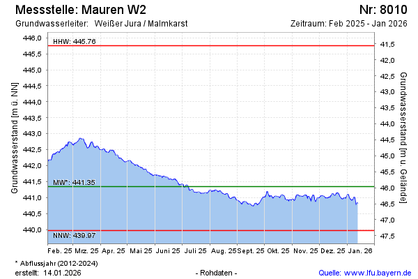
Current data Mauren W2
Groundwater level [m above sealevel]: 441.41
Distance to surface [m]: 45.9
Last value from 24.06.2026 06:00
Ground level [m above sealevel]: 487.31
| Date | Groundwater level [m above sealevel] |
|---|---|
| 29.06.2026 | 441.32 |
| 28.06.2026 | 441.34 |
| 27.06.2026 | 441.36 |
| 26.06.2026 | 441.37 |
| 25.06.2026 | 441.40 |
| 24.06.2026 | 441.41 |
| 23.06.2026 | 441.42 |
| 22.06.2026 | 441.40 |