
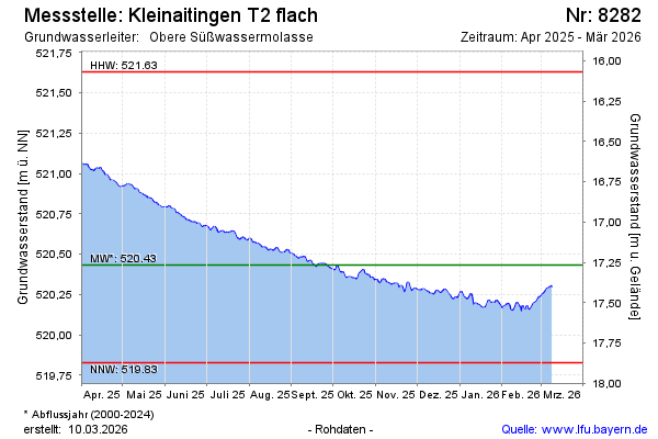
Current data Kleinaitingen T2 flach
Groundwater level [m above sealevel]: 520.09
Distance to surface [m]: 17.61
Last value from 13.07.2026 11:00
Ground level [m above sealevel]: 537.70
| Date | Groundwater level [m above sealevel] |
|---|---|
| 13.07.2026 | 520.10 |
| 12.07.2026 | 520.10 |
| 11.07.2026 | 520.11 |
| 10.07.2026 | 520.12 |
| 09.07.2026 | 520.12 |
| 08.07.2026 | 520.13 |
| 07.07.2026 | 520.13 |
| 06.07.2026 | 520.13 |