
- Start >
- Groundwater >
- Waterlevel of deep layer >
- Obere Donau >
- Kellmünz T 19 >
- Current data

Current data Kellmünz T 19
Groundwater levels of the last 12 months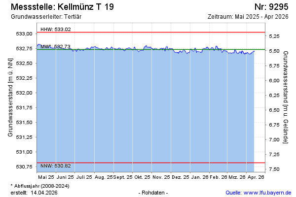
Groundwater level [m above sealevel]: 532.82
Distance to surface [m]: 5.39
Last value from 23.05.2024 08:00
Ground level [m above sealevel]: 538.21
| Date | Groundwater level [m above sealevel] |
|---|---|
| 23.05.2024 | 532.83 |
| 22.05.2024 | 532.84 |
| 21.05.2024 | 532.85 |
| 20.05.2024 | 532.84 |
| 19.05.2024 | 532.84 |
| 18.05.2024 | 532.84 |
| 17.05.2024 | 532.85 |
| 16.05.2024 | 532.84 |
© Bayerisches Landesamt für Umwelt 2024