
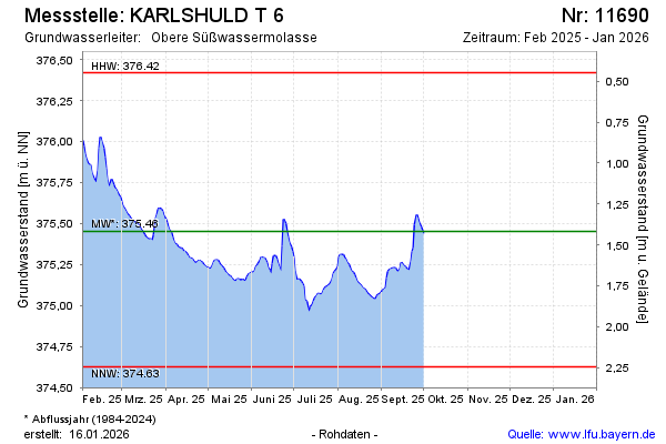
Current data KARLSHULD T 6
Groundwater level [m above sealevel]: 375.45
Distance to surface [m]: 1.42
Last value from 01.04.2026 15:00
Ground level [m above sealevel]: 376.87
| Date | Groundwater level [m above sealevel] |
|---|---|
| 01.04.2026 | 375.45 |
| 31.03.2026 | 375.46 |
| 30.03.2026 | 375.46 |
| 29.03.2026 | 375.45 |
| 28.03.2026 | 375.45 |
| 27.03.2026 | 375.46 |
| 26.03.2026 | 375.48 |
| 25.03.2026 | 375.49 |