
- Start >
- Groundwater >
- Waterlevel of deep layer >
- Obere Donau >
- Kaisheim W3 >
- Chart of total period

Chart of total period Kaisheim W3
Groundwater levels of the total period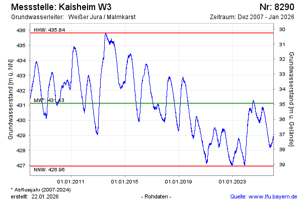
Groundwater level [m above sealevel]: 430.45
Distance to surface [m]: 35.63
Last value from 12.04.2026 12:00
Ground level [m above sealevel]: 466.08
| Date | Groundwater level [m above sealevel] |
|---|---|
| 12.04.2026 | 430.46 |
| 11.04.2026 | 430.44 |
| 10.04.2026 | 430.41 |
| 09.04.2026 | 430.37 |
| 08.04.2026 | 430.32 |
| 07.04.2026 | 430.30 |
| 06.04.2026 | 430.27 |
| 05.04.2026 | 430.29 |
© Bayerisches Landesamt für Umwelt 2026