
Current data Illertissen T 12
Groundwater level [m above sealevel]: 489.35
Distance to surface [m]: 35
Last value from 14.07.2026 10:00
Ground level [m above sealevel]: 524.35
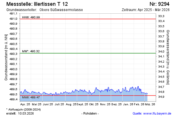
| Date | Groundwater level [m above sealevel] |
|---|---|
| 14.07.2026 | 489.36 |
| 13.07.2026 | 489.35 |
| 12.07.2026 | 489.35 |
| 11.07.2026 | 489.37 |
| 10.07.2026 | 489.38 |
| 09.07.2026 | 489.38 |
| 08.07.2026 | 489.39 |
| 07.07.2026 | 489.39 |